Valbonë Valley National Park

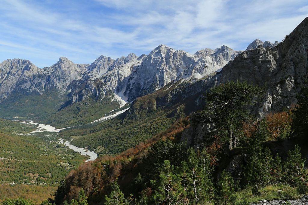
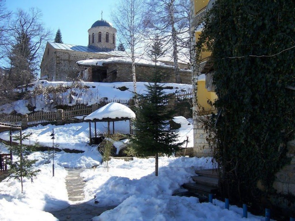
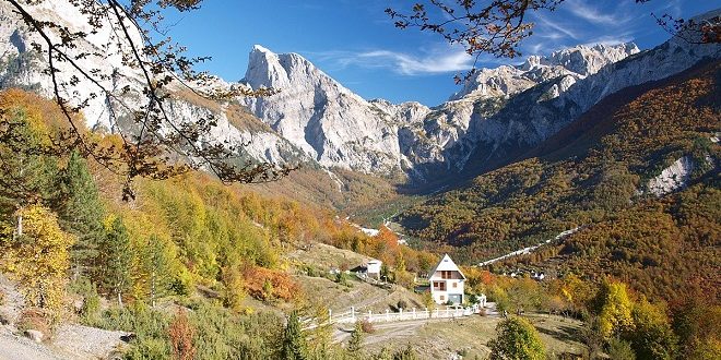
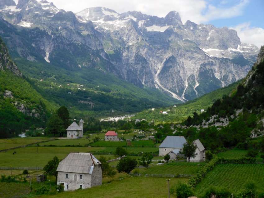
The Valbona Valley National Park (Albanian: Parku Kombëtar i Luginës së Valbonës) is a national park inside the Albanian Alps in northern Albania. The park covers a total area of 80 km2 (31 sq mi), encompassing Valbona River and its surrounding areas with mountainous terrain, alpine landscapes, glacial springs, deep depressions, various rock formations, waterfalls and the Valbona Valley with its dense coniferous and deciduous forest. It is characterized by its very remote areas which have a large preserved ecosystem all of which is primarily untouched with pristine quality. This vast pristine ecosystem is the centrepiece of what has been referred to as the Albanian Miracle of the Alps.

The park borders Montenegro in the north, Gashi Nature Reserve in the east, Nikaj-Mërtur Regional Nature Park in the south and Theth National Park in the west. It is proposed to expand the park’s boundaries and merge it with Theth and Gashi. Furthermore, Albania, Kosovo and Montenegro are planning to establish a transboundary national park, that will be called the Balkan Peace Park. The peace park would encompass Valbonë Valley along with Theth National Park, Gashi Nature Reserve, Nikaj-Mërtur Nature Park, Bjeshkët e Nemuna National Park in Kosovo and Prokletije National Park in Montenegro.

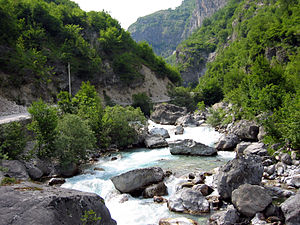
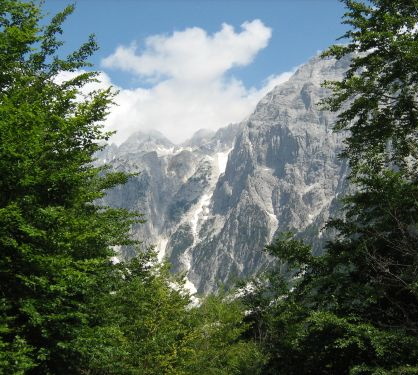
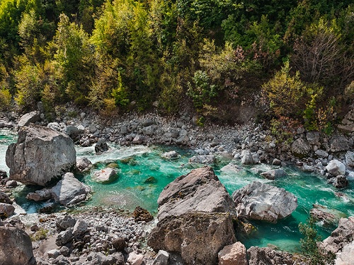
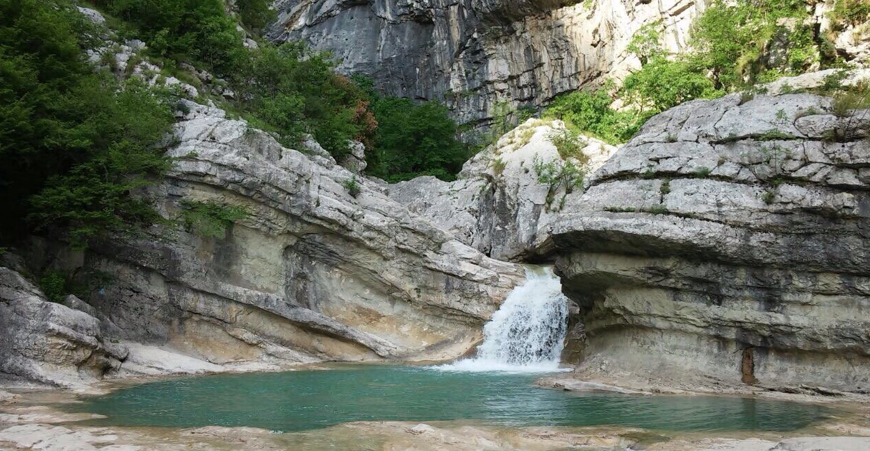
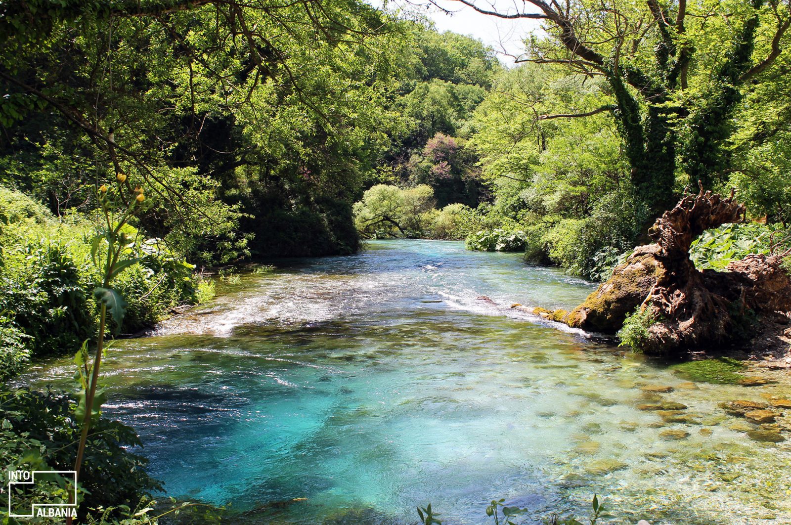
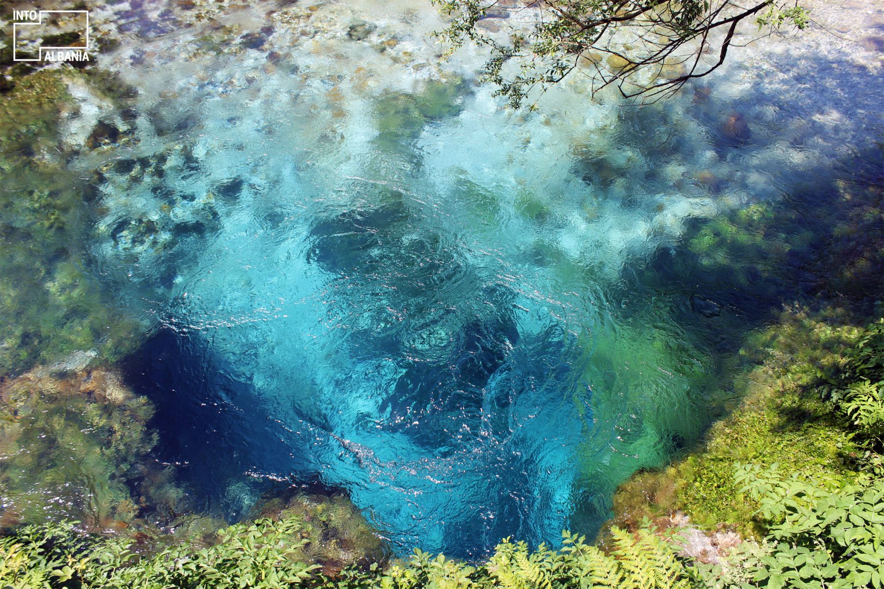
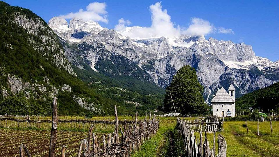
The Albanian Alps are one of the most impressive and notable topographic features of Albania. Being the southernmost continuation of the Dinaric Alps, it forms a section of the Alpine-Himalayan orogenic belt, which extend from the Atlantic Ocean to the Himalaya Mountains. The mountains are characterized by limestone and dolomite rocks and shows major karst features. Maja Jezercë sprawls in the west of the park and is the highest mountain of the Dinaric Alps, with an altitude of 2,694 m (8,839 ft). The Valbona River originate from several karst springs along the south of Maja Jezercë and the east of Valbona Pass. It is the largest river within the Albanian Alps and drains the entire eastern portion of the range. Over the past few million years, glaciers have at times covered most of the park. During the Würm period, the glacier of Valbona reached a total length of 9.5 kilometres. Nowadays, there are two very small active glaciers close to the northeastern edge of Maja Jezercë.

The park’s remoteness and relatively small human population, combined with the great variation of ecosystems and climatic conditions favours the existence of a rich variety of flora and fauna distributed throughout the land area. Most of the park consists of forest, covering 89% of the overall surface area. Brown bears, grey wolves, lynxes, roe deers, chamoises and wild goats are the primary predatory animals in the park. The park’s forests are characterized by the predominance of different tree species, with beech, pine and oak. Notably, the most important tree species used to be the norway spruce; it is one of few regions in Albania where this type can be found.

Valbonë Valley National Park was established in accordance with Decision of Council of Ministers number 102, dated 15 January 1996 in order to preserve the natural ecosystems and landscapes along with their vegetation and biodiversity communities and habitats. An expansion plan to increase the park’s boundaries to cover the Theth National Park and Gashi Nature Reserve is under consideration. With this expansion, the park will become the largest protected area not only in Albania but also in the Balkans.

The International Union for Conservation of Nature (IUCN) has listed the park as Category II. Located within the park, the Gashi River is included into the UNESCO Primeval Beech Forests of the Carpathians and Other Regions of Europe. It is also part of the European Green Belt, which serves as a retreat for endangered and endemic species. The park applied also to join the EUROPARC Federation. Plantlife has recognised the park, as well as the Albanian Alps, as an Important Plant Area of international importance, because it supports great plant species. The region is part of the Emerald Network, the ecological network made up of Areas of Special Conservation Interest designated under the Bern Convention.

Biology

Even though the park is small in surface, on its area thrive hundreds of threatened and endemic animal and plant species. The levels of vegetation in the Albanian Alps meet the alpine level, from upland valleys through the montane mountain stage on forest-free alpine and subalpine mats and subnivale tundra caused by permafrost in vast heaps of rubble with raw soils.

In view of phytogeography, the park falls within the Dinaric Mountains mixed forests terrestrial ecoregion of the Palearctic Temperate broadleaf and mixed forest. The forests of the park are covered by a mixture of deciduous and coniferous trees growing on limestone and dolomite, which is characteristic to the Albanian Alps. The most typical feature of the park’s landscape is represented by its forests being a major resource in terms of their ecological functions, as well as in terms of the beauty they lend to the landscape.

Demography

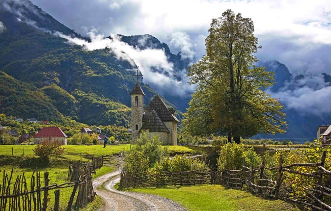
Valbonë Valley has been inhabited since classical times what argues for the proper conditions that valley provides. The villages where the population is concentrated are: Rrogam, Valbona, Dragobi and Çerem which are located at the valley extensions.After 90’ the situation began to change. As a result of not favorable economic conditions, the majority of the population moved out. Valley is inhabited by “Krasniqi” and “Gashi” tribes. A part of the population that has left the village, is settled at lower villages of Margegajmunicipality. Despite the recent changes that have been made in the demographic structure, the population still differs for its vitality. This affects at their ability to be active in the sector of tourism. Only during the years 1995-2002, villages like Çerem and Rragam have had a population decrease respectively of 63% and 57%.In 2008 the population at these villages was 920 persons but now it is 817. Stopping the phenomenon of the people leaving their country, is important, in order to reduce the risk of villages turning into seasonal ones.

Agriculture

Agriculture is ranked on the top in the economical structure of the area since it provides income for majority of the local people. Agricultural land is generally scarce and located on the slopes and some small valleys. Land users care for both, the preservation and cultivation. The land is divided into portions, according to family property. A particular thing of the area is that the possibilities of irrigation of agricultural land are numerous and unlimited. Agricultural land is mainly used to cultivate corn, potato, rye, beans, vegetables and fodder. Agricultural and livestock products are completely natural (organic).[53] Food is generally fresh and home made, but sometimes it can be even canned and processed by the inhabitants of the village.[56] Their way of cooking is entirely traditional. Besides agriculture, inhabitants deal with breeding of livestock such as cattle, sheep, goats, horses, poultry, beekeeping etc. Locals produce products such as meat, milk, wool and skins.

Tourism

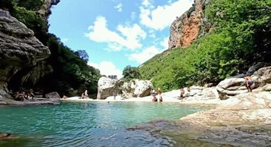
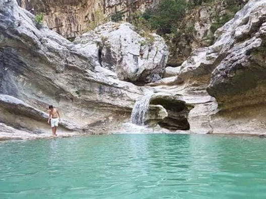
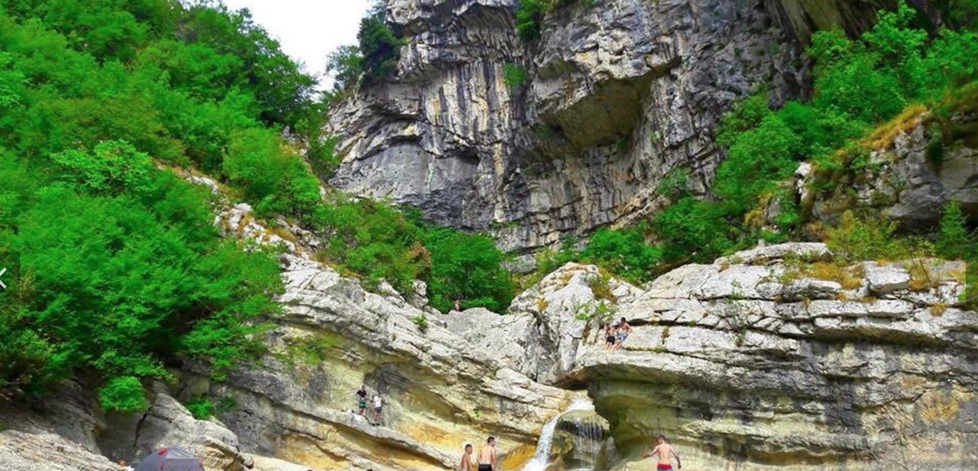
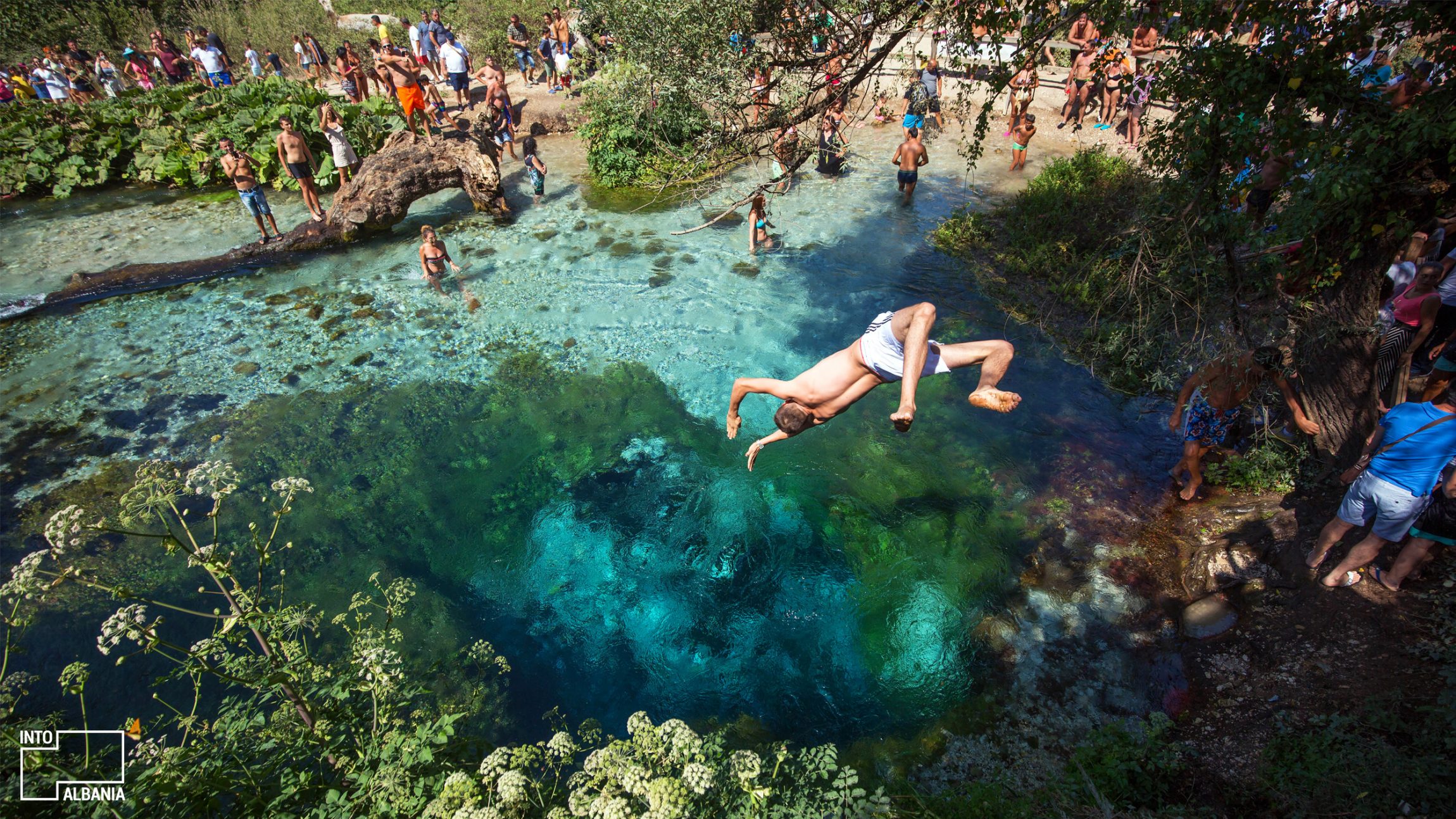
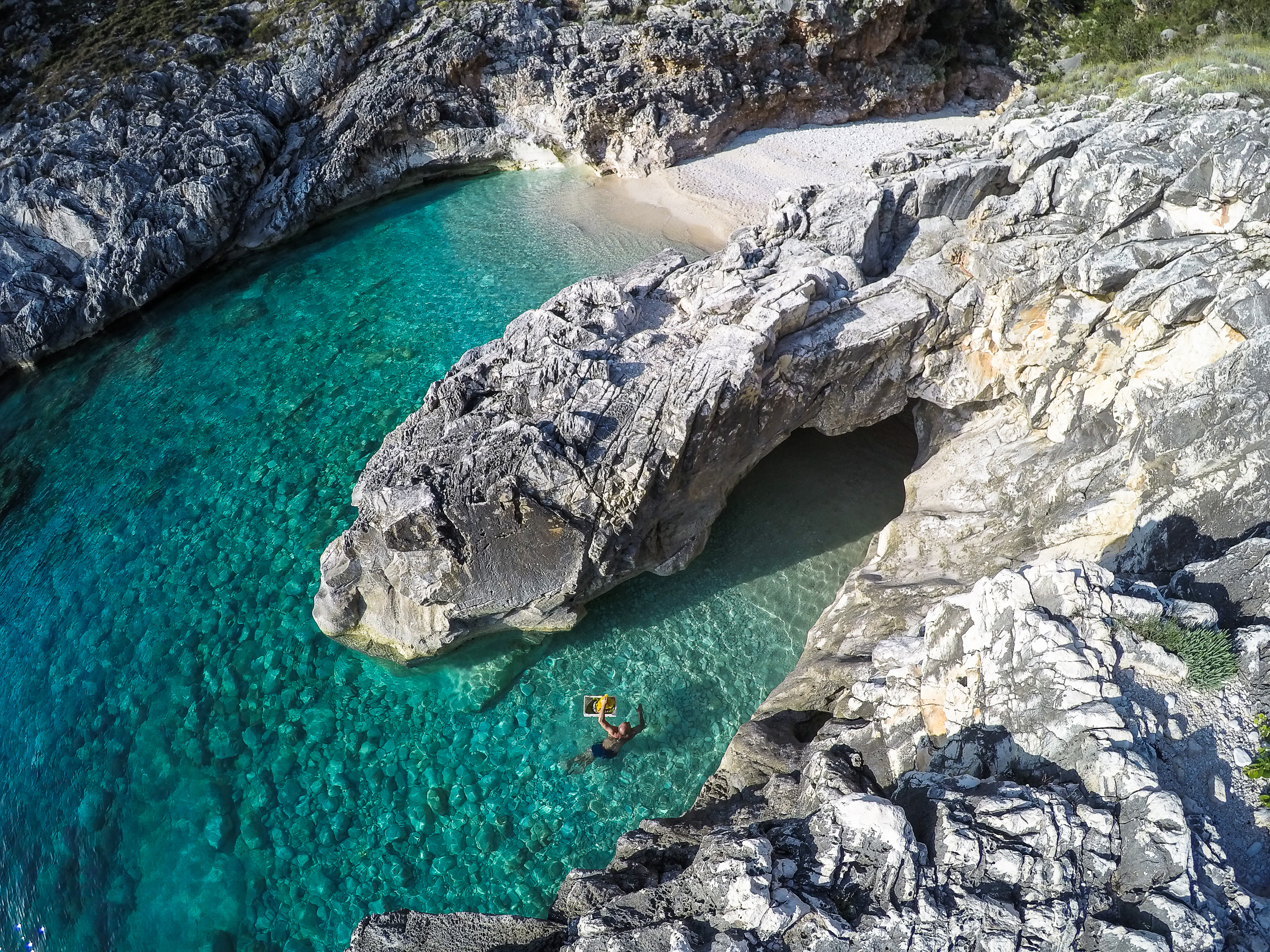
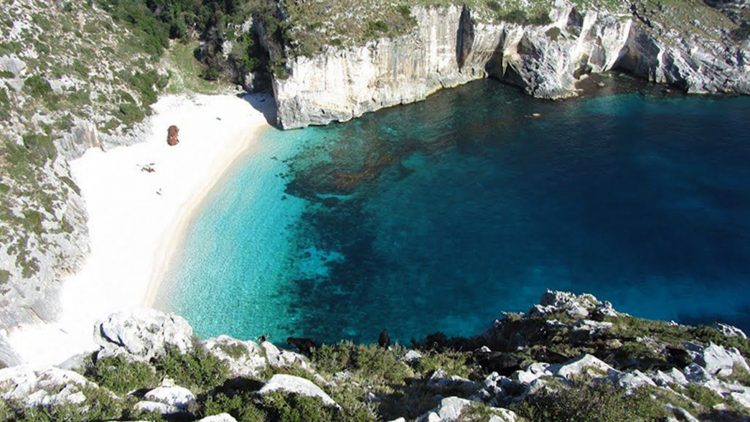
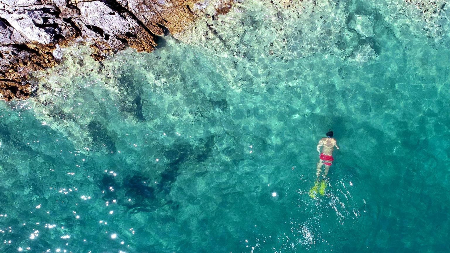
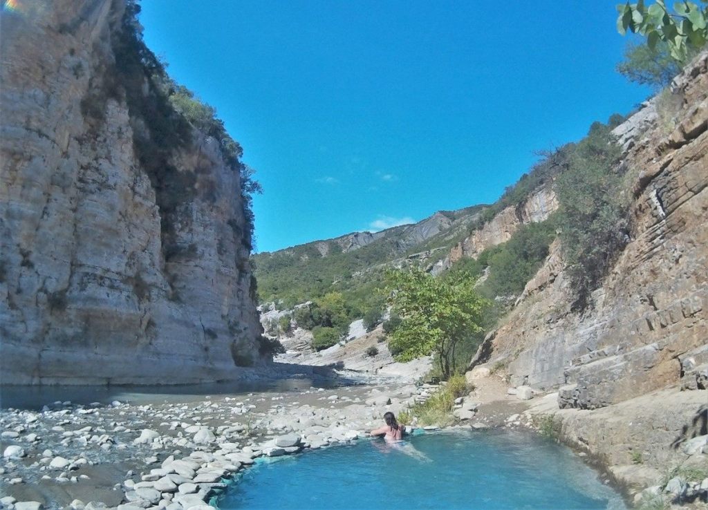
Considering the benefits that tourism can provide, the national government has classified it as a priority. Even though it is based mainly on nature, the tourism in Valbona requires the necessary infrastructure. The rocky peaks of mountains such as the Mount Jezercë, Kollata e Keqe Mount, Pecmarra Mount attract the attention of visitors. The Valbona River is unnavigable because of the frequent rains. The nature is rich in suitable varieties for tourism such as fishing and mountaineering. The numerous potentials of the valley enable the developing of several types of tourism such as climbing, white, rowing, rural, cultural, gastronomic, medical and adventurous tourism.

Alpinism is based at the presence of high mountains. Foreign tourists practise mostly this kind of tourism in Valbona.

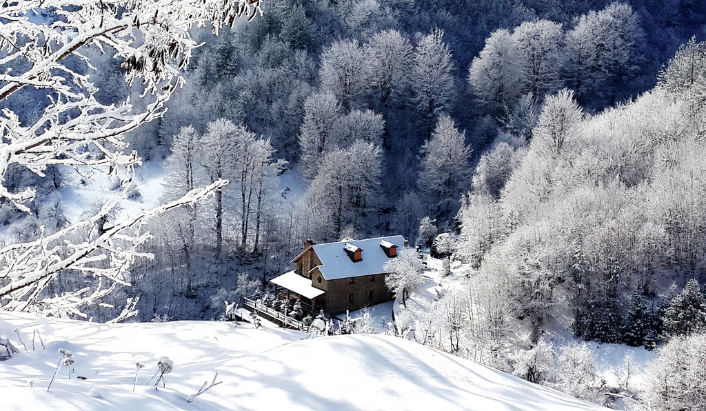
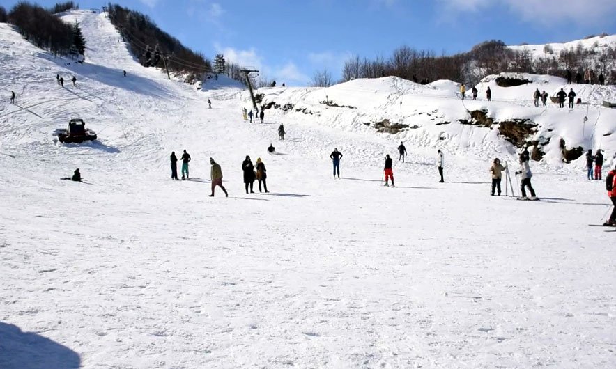
White tourism, is seen just like a potential, as the infrastructure needed for this kind of tourism is not suitable, despite the presence of snow for about 6 months.

Rural, cultural and gastronomic tourism is based in the locals lifestyle, legacy and traditions which has been treasured by them.

Medical tourism is based on the healthy climate, clean air and water and the organic foods that valley offers.

Adventure tourism has suitable conditions to be developed due to the wild nature.

Local people are building up their income with tourism activities such as renting rooms, accompanied by characteristic local hospitality and traditional home made cooking. Initiated and supported by the Government of Albania, the Albanian Development Fund and Margegaj Municipality is being built a tourism complex which should accommodate around 500 people, on a surface of 4200 m2. Valbona National Park is expected to be one of the most important oases of the country. Clean air, high mountain peaks, lakes, numerous water resources, forests, mountains, flora and fauna of Valbona Valley National Park provide conditions for eco-tourism experiences.

Cyclops’ eye

Cyclops Eye has become one of the most amusing and relaxing tourist destinations in Tirana. This natural pearl, hidden in the Krraba outfall, attracts everyday a number of visitors and adventure-lovers willing to face the wild nature. The small cataracts unified by the multitude of rocky formations create a panorama that is hardly found anywhere else. Beside the stunning view Cyclops Eye offers the opportunity to take a bath during those hot days. Another advantage of this tourist destination is its location in proximity of Tirana, reachable with low cost of transportation.

How to get there?

To go to the Cyclops Eye, in Albanian “Syri i Cikllopit”, you have to pass through a narrow path for about 1 hour by walking from the village of Krraba. Maybe it seems a little bit difficult to go there, but the views are worth to take this road. The path to the heart of Cyclops requires an adventure soul and willpower because the terrain in this area is a little difficult and you should be in good shape and health in order to become part of this journey. This is a good opportunity of tourism, where you can do hiking, bathing, and a fantastic way to replace swimming pools with natural ones. But to reach fast the destination, it’s better to have a licensed guide.

What the legend says? According to legend, the Cyclops during a duel fight with the beast, he fell out from the abyss and lost an eye and his heart. His eye and heart create a basin with cold water, where you can dive in 5 meters depths.

The Blue Eye

As unexpectedly spectacular as the coast of Southern Albania is (and it is magnificent!) what you would expect to see there are sights reminiscent of the Mediterranean more so than the tropics. Yet, as we know by now, Albania is the land of the unexpected! The country hides its own small tropical paradise, aptly called the Blue Eye (in Albanian: Syri i Kaltër). Perhaps the most breathtakingly beautiful sight in Albania, the Blue Eye is located about a 30 minute drive away from the coastal city of Saranda on the road to Gjirokastra (all places to see, by the way!). Surely, the surprise factor adds to the beauty of the entire experience. To find the tropics in Albania is no small feat!

Perhaps describing the multidimensionality and depth of this surreal beauty is futile, but one must try! The landscape leading to the Blue Eye uncovers this anomaly of nature as you will find yourself surrounded by palm trees, wild ferns and tropical plants, as well as dense, mountainous forest vegetation of oaks and sycamores, all at once! This vegetation is kept lush and glorious by the spring flowing down the mountain into the Bistrica River. A total of eighteen springs are dispersed along the site! The fresh water spring from the Gjerë (in English: Wide) Mountain flows into the Blue Eye and creates a natural pool with depths of about 50 meters. Or, so they say! The actual depth has not yet been determined. Many divers have tried to get to the bottom of it, to no avail.

This Blue Eye is intense! As you look into the center of this pool, you will begin to understand where the place gets its name. The deep blue sapphire waters of the center form the pupil of the eye and are surrounded by the vibrant emerald greens, teals, and turquoise of the iris. The eyelashes are formed by the surrounding vegetation. The waters, though deep and blue, are so crystal clear that they reveal the rocks and vegetation at the bottom. The water maintains an “only for the brave” temperature of no more than 10Celsius (50Fahrenheit). During the summer, many challenge the cold water temperatures by diving straight into the center of the “eye.”

The Blue Eye is an oasis of fresh air and cool climate, a tropical paradise that can rival any in Venezuela or the Maldives! In the summers, it provides a shelter from the relentless sun of the southern coast. Alternatively, after the cool dip into the Blue Eye, you will want to revisit the warmth of the Ionian, where the Blue Eye also flows into. Lonely Planet calls it magical and hypnotic, Atlas Obscura breathtaking and mesmerizing.  Those who have had the fortune of seeing the Blue Eye have felt god-like and omnipotent. And so will you!

Trust me, to paraphrase Nietzsche, you will gaze long at this abyss and it will definitely gaze back into you but what you will find here is pure beauty!

How to reach the place: 30 minutes by car from Saranda. You will stop at Muzinë village, near the national road Delvina-Gjirokastra. There are no direct buses to the site but you may take the bus to Gjirokastër. Just remember to ask the driver to drop you off near the natural site, Syri i Kaltër. Not to worry as in Albania, this is perfectly normal bus ettiquete!

Dardhë

Dardha is a community in the former municipality of Drenovë in the Korçë County, Albania. At the 2015 local government reform it became part of the municipality Korçë. and a well known ski area of Albania since the 1920s. In 2012, the first ever ski tow in Albania was opened at Bigell Ski Resort near Dardhë.

Dardhë is populated by an Orthodox Albanian population and an Aromanian minority of a few families who were previously nomadic before settling in the village after 1950. Much of the Orthodox Albanian population has moved away to Albanian cities such as Korçë and Tiranë or migrated to the United States of America.

History

The town of Dardhë was first founded by a group of Orthodox Albanians fleeing into the mountains to avoid Ottoman administration. During Ottoman rule Dardhë, unlike villages located in the Grammos mountains, did not undergo any serious collapse or destruction.

A Greek school was founded in the village in 1810 by Ikonomou Isidoros, while at the beginning of the 20th century Greek education was flourishing with the establishment of additional schools: a girls’ school (1901-1902) and a middle level school. In the school season of 1901-1902 a total of 150 pupils attended the Greek schools, which were sponsored by the local community fund, as well as the local Orthodox Church. The first Albanian school opened in 1917, with the initiative of Leonidha Çika, starting with initially 20 pupils, and with financing from the Vatra, which will sponsor the new school in 1924 that is still in place today.

Dardha has historically suffered from heavy emigration. Many families of the area would become the first Albanian community in USA, and Romania as well. People from Dardha have been immense contributors to Albanian American organizations. Sotir Peçi, Josif Pani, Gjergj Konda etc. would start the society “Besa-Besë”, “Kombi” newspaper, and the unification of the Albanian American societies into a single federation, Vatra, with Sotir Peçi as one of the initial founders. Current Prime Minister Edi Rama has some family roots in Dardhë. In the past years, it has become a destination mainly for internal tourism by rich Albanians, creating jobs for Dardhë residents.

Karaburun

A finger of land jutting into the Adriatic Sea, Albania’s Karaburun Peninsula is nothing if not rocky.

They carry the kind of names that only enhance their sense of mystery – one is called Gramata, or Bay of the Scripts, another is known as Bay of Ragusa, a town in Sicily and the name by which Croatia’s Adriatic coastal town of Dubrovnik was known when it was a city-state. Others are grouped together under the name Ravena Plateau, Ravena being the name of another Italian town.

A few dirt roads carved out by the Albanian army run along the eastern side of the peninsula, but they are off limits to civilians due to the proximity of a naval base at the southern end of the Bay of Vlora.

A first trip set off from Vlora harbour at a cost of 2,500 leks per person (about 20 euros), taking in the cavernous Haxhi Ali Cave and one of the few beaches on the eastern side of the peninsula where a small restaurant served grilled meat and fish, salad, local white sheep’s cheese and French fries.

At the end of the peninsula some 15 kilometres from Vlora town, the Haxhi Ali Cave is so big that it can host a small ship or several speedboats at the same time. It can take up to 30 minutes to get there, depending on how fast the captain is prepared to go.

The location is steeped in pirate myth and legend and more recent tales of traffickers in drugs and people who used it to shelter from bad weather and police.

There are several organised speedboat trips there per day; visitors can swim in the cave’s highly saline waters as light dances on the ceiling.

The second trip took us from the village of Dhermi, on the other side of the peninsula from Vlora, to the Blue Cave and then Gramata Bay, the jewel of the Albanian coast.

Boats to Gramata Bay are less frequent and more expensive; in contrast to the calm waters of the Bay of Vlora, the Ionian Sea and the Strait of Otranto are often rough. The trip can cost roughly 150 euros for up to six or seven people.

The only other way is by foot, but it can take six hours and you need a good supply of drinking water.

Benja Thermal Baths

THE BATHS WITH BREATHTAKING VIEWS

Enjoy a dip in the warming natural waters of the Benja Thermal Pools, surrounded by some of Albania’s most scenic natural beauty – a must for outdoor types!

Inspirational Beauty

The gods must have been truly inspired when they conceived the town of Përmet, blessing it with a timeless picturesque landscape. Here, the mountains, hills, rivers, and forests play a truly breathtaking game of hide-and-seek! Përmet has gradually become one of Albania’s most visited destinations for outdoor adventure. Whether it’s rafting across the Vjosa River, or healthy recreation in its natural thermal baths. The Benja Thermal Pools are highly-recommended by doctors for their health benefits, but are also wonderful to immerse yourself in for no other reason than pure pleasure!

The Vjosa River flows across the entire valley, and eventually branches out into the Langarica River – the latter stretching across a canyon of the same name. The caves within the Langarica Canyon are really a sight to behold! Warm waters join Langarica’s stream, which despite the naturally cold temperature of the river, keep it at a warming 29-30 degrees celsius all year-round. These are the thermal baths of Bënja, or llixha as they are called in Albanian. They are located only 13 km from the centre of the beautiful Përmet. People flock here to seek recovery from rheumatism, skin, and  kidney ailmentsn to name but a few of the symptoms known to be relieved here. They say in fact, that each thermal pool, rich in minerals, serves a particular healing purpose!

Take a healthy dip!

The Benja Thermal Pools are smooth and clear, and also contain a high content of sulphur. The stone baths are the most authentic, and as such, attract a large amount of visitors all year-round. The winter, when the temperature in Përmet falls below 0 degrees celsius is the best time to immerse yourself in these hot baths. Enjoy that satisfying contrast between the air and water! Remember though, 20-25 minutes in the pool usually suffices! More time in the highly sulphuric waters can be quite overwhelming, and not necessarily that good for you.

Don’t be surprised if you notice people here covered entirely in black mud! These muddy deposits of the thermal waters contain regenerative properties for the skin. The waters flow from the deep chasms of the cliffs surrounding the Langarica Canyon. They have been well-known for their health purposes since antiquity. You can find two of the largest and most popular baths at the foot of the Bridge of Katiu (the Judge’s Bridge). These are known for being particularly beneficial for curing gastric and rheumatic diseases. A visit to these natural baths provides you with wonderfully natural health benefits, whilst taking in the spectacular scenic landscape of Përmet.

The beautiful Ottoman bridge is another popular attraction in an area highly-regarded for its archaeological value. The earliest objects found in the cave settlements here belong to the Neolithic (7000-3000 BC) and the Eneolithic (3000-2000 BC) periods.

Theth

This unique mountain village easily has the most dramatic setting in Albania. Just the journey here is quite incredible, whether you approach over the mountains on foot from Valbona or by vehicle over the high passes from Shkodra. Both a sprawling village along the valley floor amid an amphitheatre of slate-grey mountains, and a national park containing stunning landscapes and excellent hiking routes, Theth is now well on its way to being Albania’s next big thing. An improved – though still incomplete – asphalt road from Shkodra has made access to this once virtually unknown village far easier in recent years, bringing with it the familiar problem of overdevelopment. Come quickly while Theth retains its incomparable romance and unique charm.

History

Local tradition asserts a single common ancestor for the community (one Ded Nika) and suggests that the population moved to Theth some 300 to 350 years ago in order to preserve their (Catholic) Christian traditions.

Visiting Theth in the early 20th century, the traveller Edith Durham said:

I think no place where human beings live has given me such an impression of majestic isolation from all the world.

Durham described Theth as a “bariak” of some 180 houses and also observed that it was almost free from the tradition of blood feud (known in the Albanian language as Gjakmarrja) which so blighted other parts of the Albanian highlands.

Theth remains remote. It is most easily accessible by a 25 km unmade road from the village of Boga which is impassable during the winter months and is not generally suitable at any time of the year for motor vehicles without off-road capabilities.

Although the Kanun (traditional Albanian law) remains influential, Theth has not suffered from the recent (post-Communist) reappearance of the blood feud which has troubled other areas of Northern Albania. Theth boasts one of the very few remaining “lock-in towers”, an historical form of protection for families that were “in blood”.

Depopulation represents a serious long-term challenge for the community. The population has been greatly reduced over the past few decades and the majority of those remaining occupy Theth only during the summer months. However, the community has a nine-grade school and recent efforts have been made to stimulate tourism. A number of local families offer board and lodging to visitors who come to Theth to hike in the National Park – or merely to admire the mountain scenery.

Apart from the lock-in tower, other attractions include spectacular waterfalls, a working watermill (still used to grind the local inhabitants’ corn) and a modest ethnographic museum.[6]

There are now two projects working in the vicinity, aiming at improving and helping the tourist infrastructure in the area. A Balkans Peace Park Project is working towards the creation of a park extending across the borders of Albania, and Kosovo and has taken a lead in recent years in encouraging sustainable and ecologically sensitive tourism in and around Theth (for example by funding the marking of footpaths). Project Albanian Challenge has built a new bridge, which connects Theth to the nearby Grunas waterfalls over river Nanrreth. The project has also improved the marking of the trail to Curraj i Epërm, and has marked another approx. 80 kilometers of brand new trails in the nearby valleys, and created an opensource, free map of the area.

Archaeological Park of Byllis

THE MODERN CITY OF ANTIQUITY

Near the cities of Fier and Ballsh stands the Byllis Archaeological Park, the largest ancient Illyrian city in the south of Albania. Several majestic constructions were erected in Byllis during the 4th and 5th centuries B.C. Throughout your visit, you can admire the beautiful ruins of the theater, stadium, water depots, gymnasium, promenades, remains of former dwelling spaces and some of the most valuable Palaeo-Christian ruins in Albania.

The ancient city of Byllis was divided into three separate areas and constructed according to the architectural plan of the renowned ancient Greek architect Hippodamus of Miletus, otherwise known as the father of European urban planning. This architect’s expertise and magnificent work is evident here!

Byllis Theater

Among other wonderful sights, what remains from the golden age of Byllis are the beautiful ruins of the 7500-seat theater, whose atmosphere instantly transports you into the history and architecture of the ancient city. Parts of the theater’s forty rows of tiered seats, supporting walls and the orchestra’s pedestal can still be seen today.undefined

The Stadium

The Byllis Stadium affords views of 19 stairs made of ancient stone, whose impeccable shape explains why this particular stadium is ranked as the second most well-preserved one of the country, surpassed only by the stadium in Amantia, an equally beautiful archaeological park near the southern city of Vlorë. In addition to its necessary public facilities, the city of Byllis had its own workshops of pottery, construction, sculpture, metallurgy as well as its own presses where the city’s coins were made.

Sightseeing

During the 5th century A.D., several churches were constructed whose ruins currently constitute some of the most important Palaeo-Christian remains in Albania. To date, five of them have been discovered, both inside the city walls and outside. The Archaeological Park of Byllis is situated on top of the hills of Mallakastra, from where beautiful panoramas of the Vjosa River and the surrounding green landscape, as well as the country’s ancient history, can be truly absorbed.  It is for good reason that one of the epigrams discovered in the area reveals the following words: “O stranger, do not look away from the great beauty of Byllis.”

Design a site like this with WordPress.com
Get started